The national land use control and supervision system, with the main goal of monitoring the entire life cycle of land use, focuses on solving problems such as "scattered data, complex rules, high difficulty, and low level", achieving a "one map" overview of land use control, unified standard grouping and submission of seven types of business for land use control, intelligent quality inspection and verification of data packages, and dynamic supervision of electronic supervision codes. It strengthens national land space control, improves administrative approval efficiency, effectively improves the ability and level of element guarantee, and provides element guarantee for urban planning, construction, and development.
Product Highlights:

Construction Content:
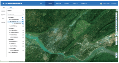
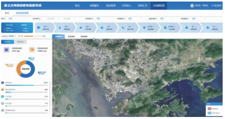
1. "One Map" for Land Use Regulation
Integrating data from current conditions, planning, and various business approvals for land use regulation to form a "One Map" for land use regulation, providing functions such as data browsing, split-screen comparison, query statistics, and spatial analysis to support the entire process from construction project land approval to construction supervision.
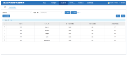
2. Indicator Management
Centrally and uniformly managing annual land disposal tasks, national indicators, local indicators, indicators for consolidating poverty alleviation achievements, and reclamation indicators, reforming land use planning management methods, and strengthening coordination between planning management and land supply, development and utilization, and inspection and law enforcement to achieve full-cycle management of land resources.
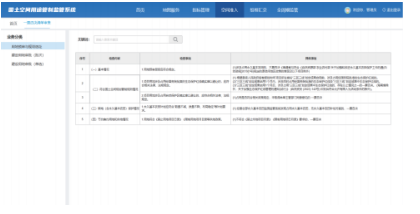
3. Spatial Access
By attaching digital land use regulation access, restriction, and prohibited project types and planning conditions as control rules during the project planning stage, implementing positive and negative list detection and other functional applications, providing technical support for subsequent project pre-review, permit approval and other links, and strictly controlling spatial access from the source.
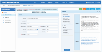
4. Document Compilation and Submission
Based on the business needs of territorial spatial use regulation supervision and data exchange specifications, achieving unified reporting, unified verification, and unified receipt of results for territorial spatial use regulation business data at provincial-city-county three levels, standardizing business verification, improving monitoring, evaluation and early warning, and promoting full-process and full-element digital intelligent services and supervision of use regulation.
5. Full Lifecycle Management
Through daily management monitoring, indicator monitoring, project stage supervision, and land supervision, supporting the full domain and full-element monitoring and supervision of land's entire life cycle including approval, supply, use, compensation, and inspection, achieving land use control, smooth conversion, total control, and system balance for various territorial space elements.
Application Cases:
Construction of Xinjiang Territorial Spatial Use Regulation Supervision System
Following the concept of "provincial unified construction with three-level application at province-city-county", the system constructs the Xinjiang Uygur Autonomous Region Territorial Spatial Use Regulation Supervision System, monitors and evaluates the implementation of territorial spatial use regulation, provides objective, timely, and quantifiable information on territorial spatial changes, and achieves full-element planning management of natural resources, full-chain use regulation implementation management, comprehensive and full-process territorial spatial feedback correction, comprehensive and full-time-space monitoring supervision and assessment. Meanwhile, it strengthens coordination with relevant systems of the Ministry of Natural Resources and coordinates data retrieval and integrated analysis of various filing systems.
Related Software
NRSMA
NRSDMS
- Natural Resource Asset Management Solution
- Intelligent Disaster Management Solution
- Solution for Urban Physical Examination Evaluation Information
- Implementation Supervision Information Solution for the "One Map" of National Spatial Planning
- Solution for Land Space Use Control and Supervision
- Green Mining Intelligent Solution


