MapGIS Client for JavaScript is a cloud GIS network client development platform that integrates MapGIS big data and cloud platform products, providing high-performance GIS, big data GIS, and other full GIS service capabilities. Integrate multiple open-source map frameworks and visualization libraries to enhance the client's ability to visualize, express, calculate, and analyze applications.

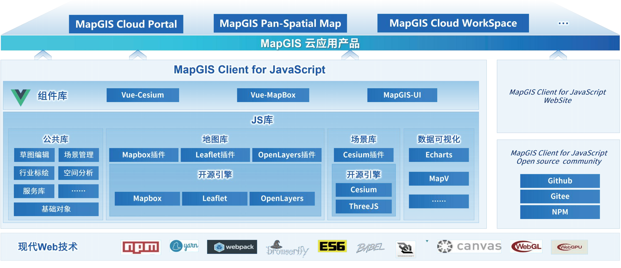
MapGIS Client for JavaScript Development Framework
Product Features
Flexible development approach
●Support H5 native JavaScript development and Vue component-based development, with a more flexible development approach
●Support the introduction of local offline, CDN online, NPM installation and other methods, making project management more convenient
●Based on the two major platforms of GitHub and Gitee, hosting core code for long-term maintenance, regular updates, and more direct access
Deep integration of open-source frameworks
●Integrate open-source map libraries such as OpenLayers, Leaflet, MapboxGL, Cesium, ThreeJS, etc
●Deeply integrate excellent visualization libraries such as ECharts, ECharts GL, MapV, etc., and integrate Turf.js client computing library
●Support the integration of cross platform frameworks such as Apache Cordova and Electron to develop cross platform and cross terminal applications
Efficient client computation and visual representation
●Support client-side operations, including buffering, stacking, topology, projection, Thiessen polygons, Tin triangulation, interpolation, center points, etc
●Support MVT open standards and coordinate systems such as Web Mercator, WGS84, CGCS2000, Beijing54, Xian80, etc
●Multiple engines support the overlay display of tile data for different cutting schemes such as custom cutting, standard latitude and longitude cutting, and standard Mercator cutting
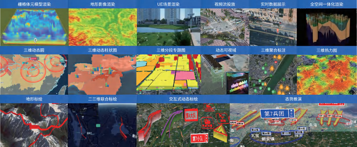
●Support the visualization expression of spatiotemporal dynamic and static data, including heat maps, scatter plots, migration maps, 3D architectural maps, O-D maps, clustering, wind fields, and other visualization effects
●Support 2D and 3D dynamic plotting, industry plotting, sketch editing, client-side thematic maps and other visual expressions
Professional 2D and 3D integrated analysis and scene special effects
●Support 100+server integrated analysis functions covering high-performance spatial analysis, 3D analysis, big data analysis, etc
●Provide rich client analysis functions, covering more than 30 types of analysis such as vector, terrain, scene, visibility, model, geological body allocation, etc
●Supports weather effects, particle effects such as accumulated rain, smoke, flames, fountains, wind fields, and a variety of aftertreatment effects
●Support for M3D model custom coloring and video tuning
●Supports comprehensive analysis functions such as drone panoramic image splicing, target detection and tracking, tunneling simulation
●Support for scene beautification through custom fragment coloring, peak coloring, water surface reflection and other special effects
Rich component resources
●Provides 300+ components including views, scenes, layers, visualizations, theme charts, foundation/industry mapping, analysis, simulation, UI, and more
●Rich CIM application components, including planning design, intellectual property management, BIM management, simulation simulation, comprehensive analysis and more
●Enhance dynamic marking components to realize 2D integrated management and joint operation such as industry symbol management, dynamic marking, situation inference
●Added multiple UI themes, support one-click theme switching

MapGIS Client for JavaScript functionality and effectiveness
Product Usage
●Download link:http://www.smaryun.com/dev/download_detail.html#/download828
●Product official website:http://webclient.smaryun.com/#/index
●Product Resource Center:http://www.smaryun.com/dev/service-space/resource?from=1#/node_id463
Related software
Desktop GIS
BD And Cloud Platforms
MapGIS CIM Basic Platform
Digital Twin Platform


